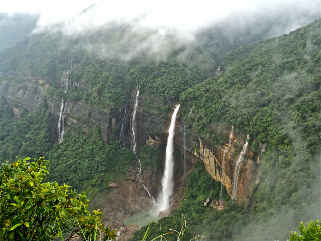
“Sohra or Cherrapunji” is a beautiful picturesque town located in Meghalaya. This town is elevated at an altitude of 1,484 meters above sea level. This town is known for its natural beauty which includes pine tree forests, flowing streams, and a number of beautiful waterfalls. This town is also sometimes referred to as “Scotland of the East”. This town also holds the Guinness Book of world record as the wettest place on earth. So if you intend to enjoy natural beauty along with romantic climatic conditions then “Cherrapunji” is certainly a place that you need to visit.
Read More: CHERRAPUNJI – FACTS ABOUT THE WETTEST PLACE ON PLANET EARTH
How to reach Cherrapunji ?
[put_wpgm id=101]
Cherrapunji Map
By train:
The closest station to Cherrapunji is in Guwahati. The Guwahati Railway Station is well linked to all the major cities and towns in the country. Taxi and bus services are available from Guwahati Railway Station to Cherrapunji.
By road:
There are a number of taxi and state and private bus services that operate from the Paltan Bazaar bus stand in Guwahati to Cherrapunji. Guwahati and Shillong are starting points which lie in close proximity to Cherrapunji.
a. How to reach Cherrapunji from Guwahati : The shortest route to reach Cherrapunji from Guwahati is via NH6 as depicted in the map above. Alternatively, click on the Google Maps link here to view on Google Maps.
b. How to reach Cherrapunji from Shillong : The fastest route from Shillong to Cherrapunji is via SH 5 and the route map is depicted above. Alternatively, click on the Google Maps link here to view on Google Maps.
By flight:
The nearest airport to Cherrapunji is in Guwahati. The Guwahati Airport is located at a distance of 181 km from the city. This airport is well connected to most of major cities and towns in the country. Taxi services from Guwahati Airport to Cherrapunji are available.
Climate and best time to visit Cherrapunji
The climate in Cherrapunji can range from “pleasant to cold”. The summer months which begin in March and ends in May is pleasant with temperatures ranging from 14 degrees to 23 degrees. Heavy rainfall is received during the monsoon season from June to September and, is considered to be the wettest place on earth while the winter months that begin in December and ends in February is usually cold with the mercury dropping to as low as 7 degrees. The ideal season to visit this picturesque town is in between October to May.
Places To Visit Around Cherrapunji
- Nohsngithiang Waterfalls: Is a beautiful waterfall nestled in the Khasi Hills at an altitude of 1033 feet above sea level. It is considered to be the 4th largest waterfall in India. This waterfall is famous for the magnificent view created due to the setting sun. This view created is a sheer treat to the eyes.
- Kynrem Falls: Is another beautiful waterfall located in the Khasi Hills District. This waterfall is extremely scenic and overlooks the Thangkharang Park.
- KhohRamhah: Is a huge single rock in the shape of a giant cone. This rock provides a magnificent view the Sylhet plains of Bangladesh. It is this breath taking view provided by this rock that makes it a major tourist attraction.
- Elephant Falls: Is a beautiful waterfall that is located at a distance of 12 km from the town. It is known for its scenic beauty and is a major tourist attraction.
- Dainthlen Waterfall: Is a waterfall that is located about 5 km from this town. It is a silent waterfall and does not produce any sound when water falls from a height. It is a popular tourist destination.
Accommodation – Hotels, Resorts and Home Stays in and around Cherrapunji :
Click on the link here to check out the places to stay near Cherrapunji, Meghalaya on Google Maps.

